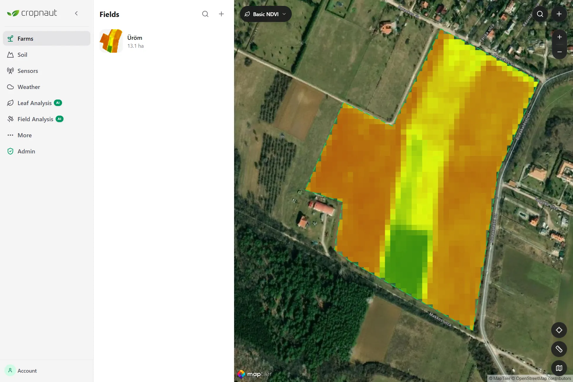
Satellite Dashboard
See your entire farm from above
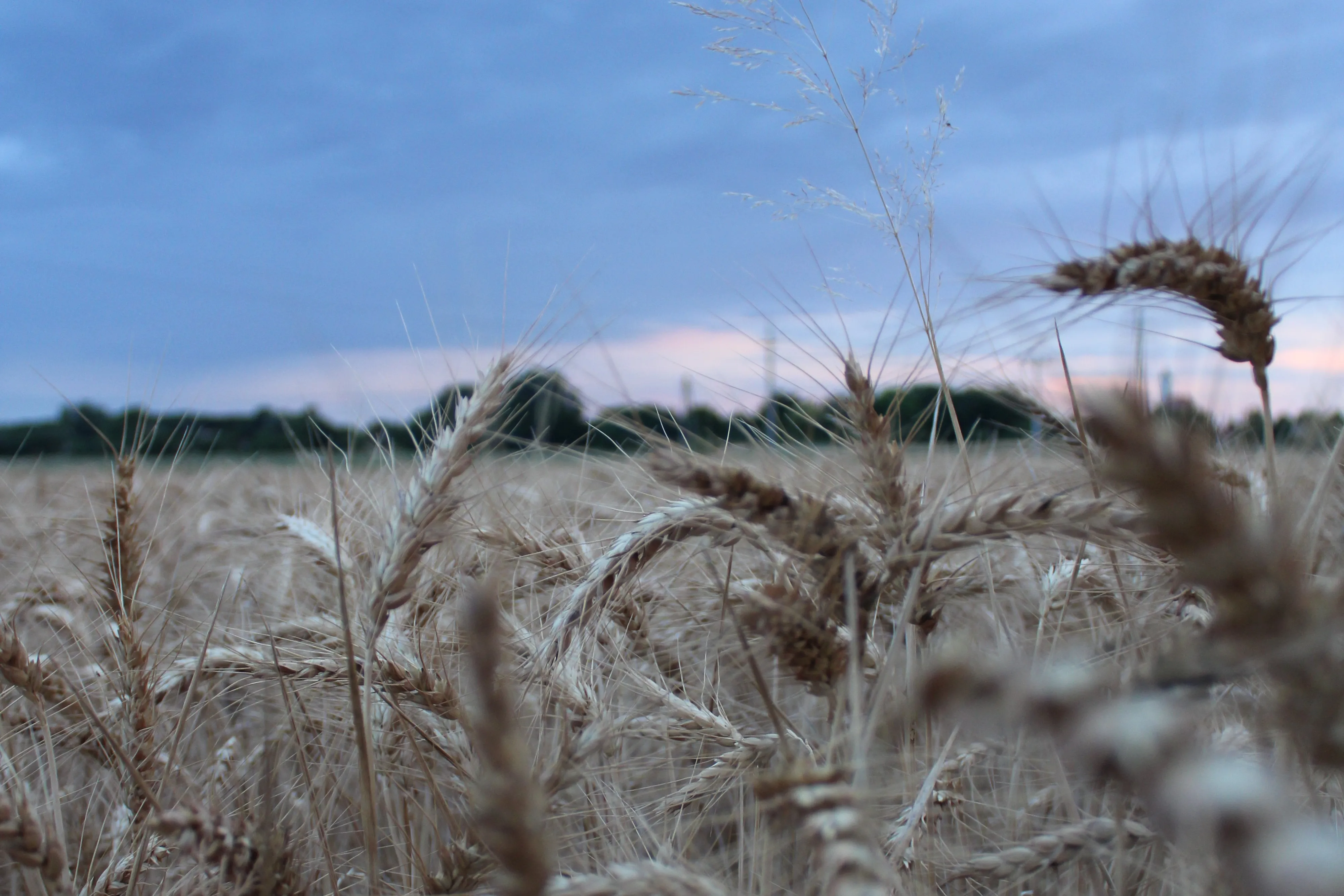
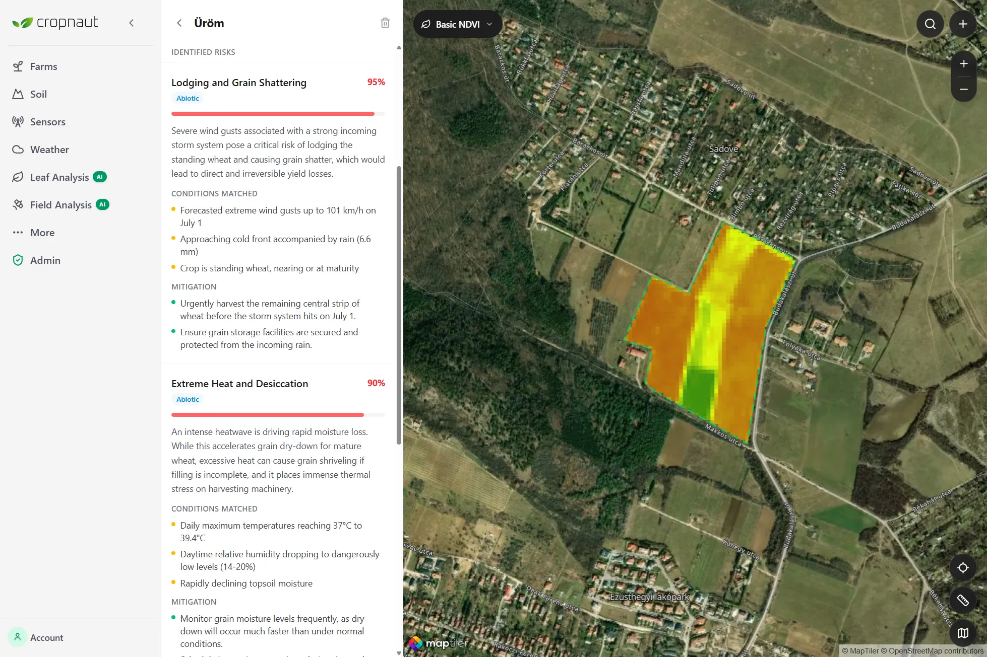
NDVI and NDWI vegetation indices updated regularly. Spot crop stress and uneven growth before they're visible from the ground.
Cropnaut combines satellite imagery, in-field sensors, and AI analysis to give every farmer a clear picture of their fields — and exactly what to do about it.


Four reasons farmers trust Cropnaut to tell them what's happening — and what to do next.
Open the app, get a field-health summary with AI recommendations. No agronomy degree required.
AI combines satellite data, weather forecasts, and soil conditions to flag risks before they're visible.
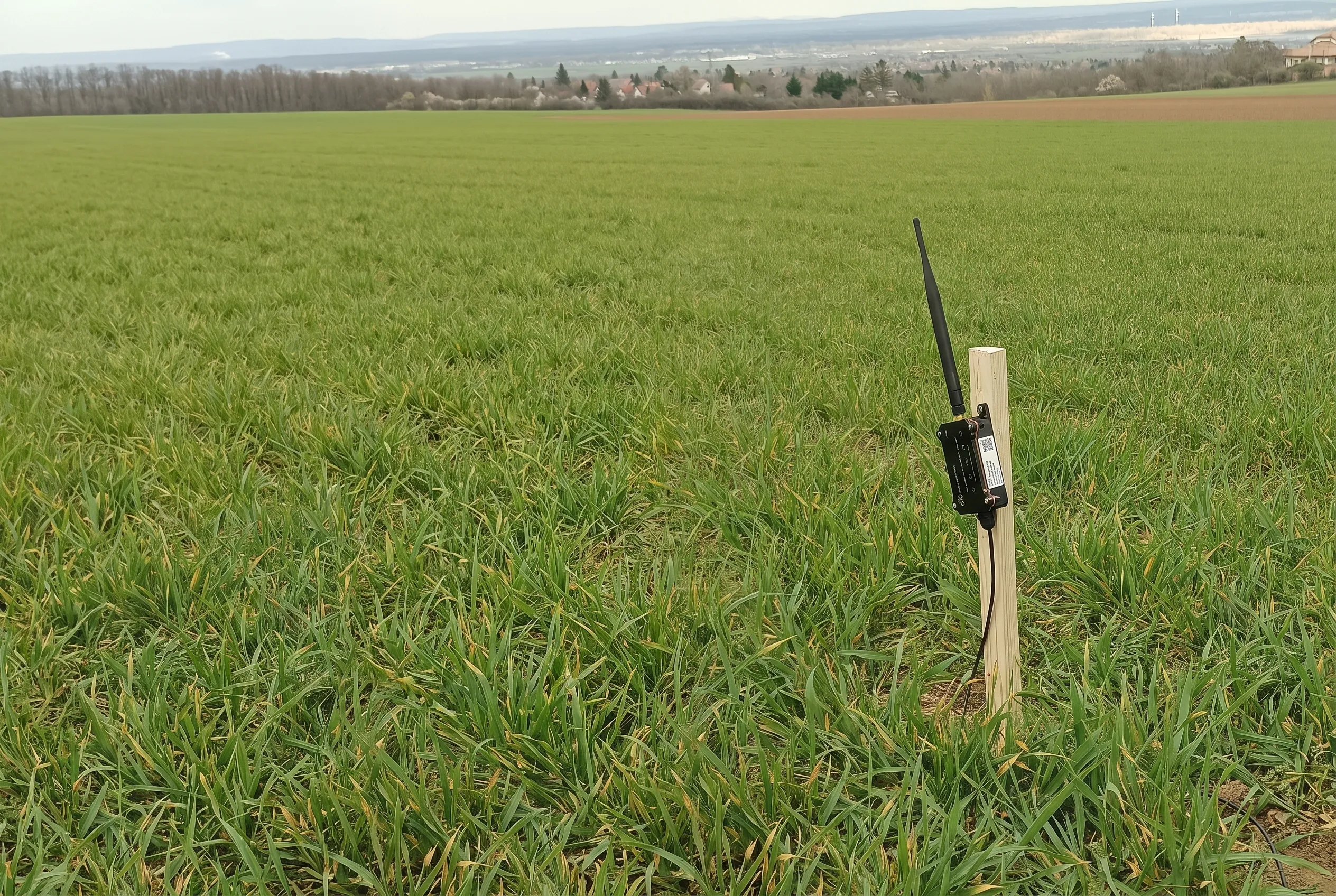
Built on LoRaWAN, Cropnaut runs independently of mobile coverage — reaching fields cellular tools can't.
Satellite, AI diagnosis, sensors, and soil forecasting in a single platform. Nothing to stitch together.
A complete precision farming platform built around clarity and action.
NDVI and NDWI vegetation indices updated regularly. Spot crop stress and uneven growth before they're visible from the ground.
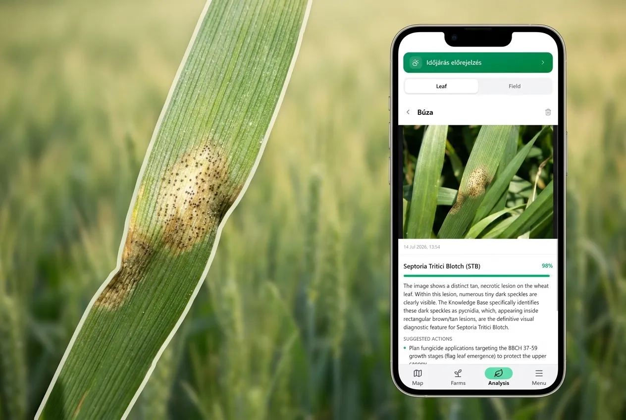
Snap a photo of a problem leaf. Get an AI-powered identification, explanation, and mitigation plan — instantly.
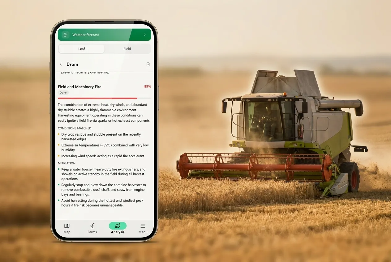
Weekly AI recommendations based on satellite indices, weather forecasts, and soil data. Cropnaut flags issues before they become costly problems.
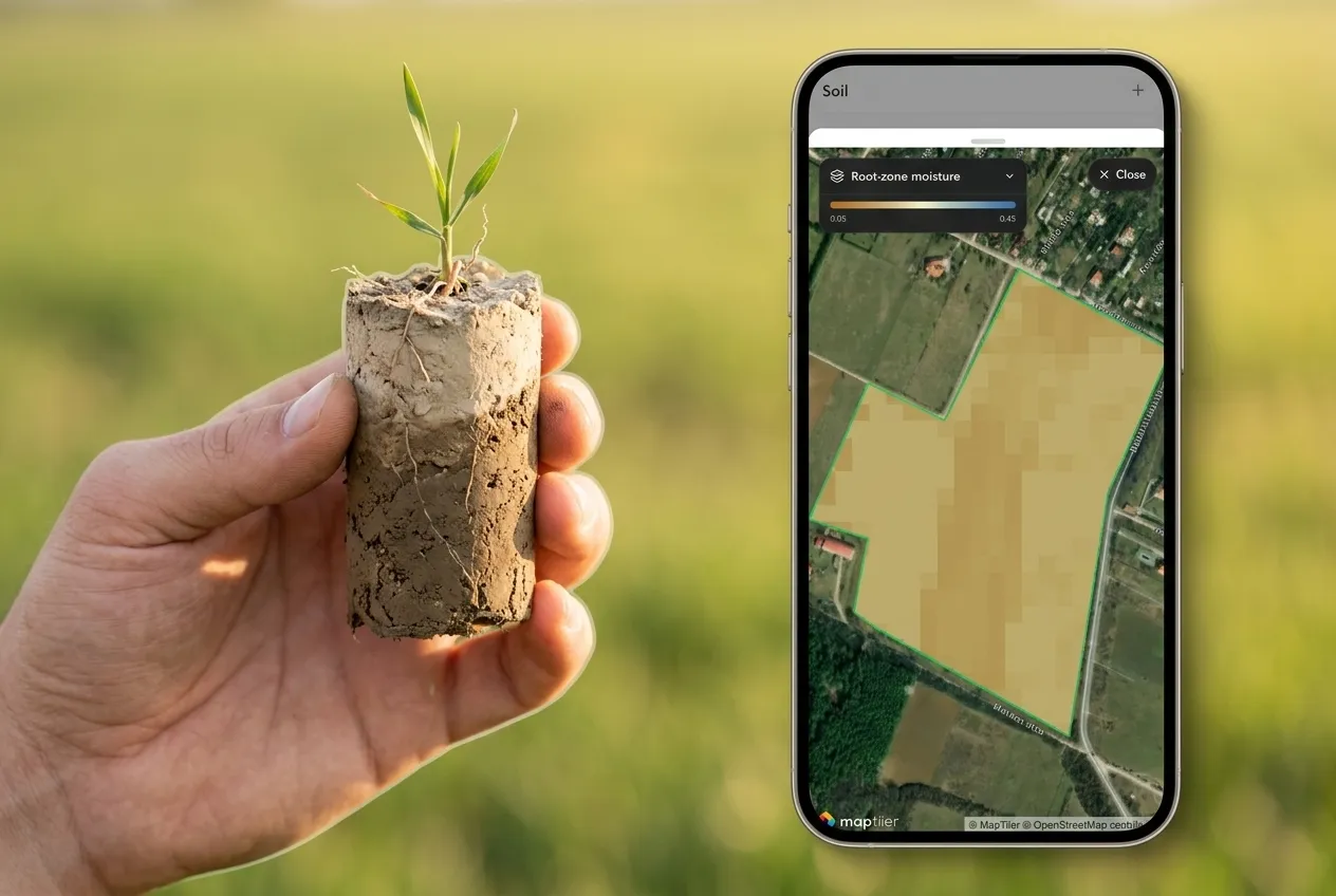
Field-level soil moisture forecasts powered by weather data. Always know what's beneath the surface.
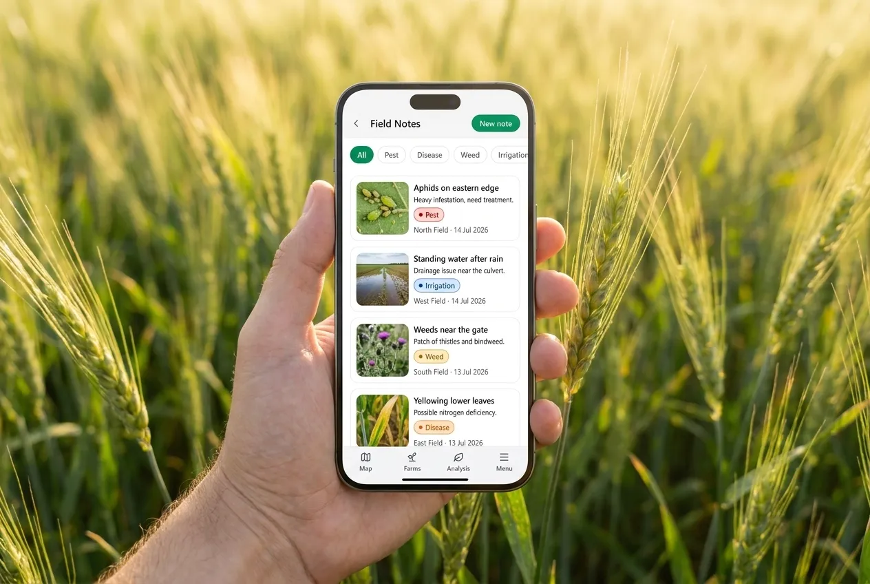
Log observations and track what you've seen across your fields — inside the same platform you use for everything else.
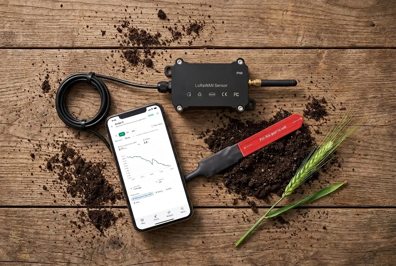
Live soil moisture, soil temperature, and air temperature readings from in-field sensors, directly in your dashboard.
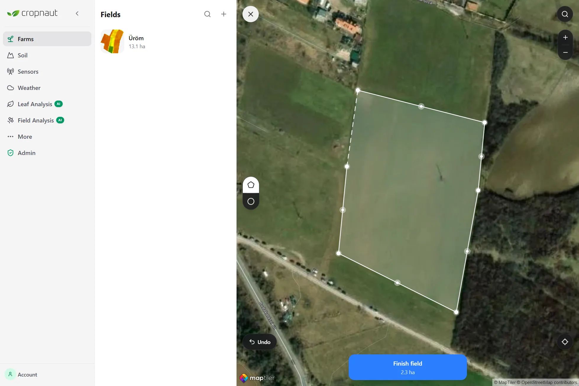
Draw your field boundaries on the map. Satellite data loads immediately — no hardware required to get started.
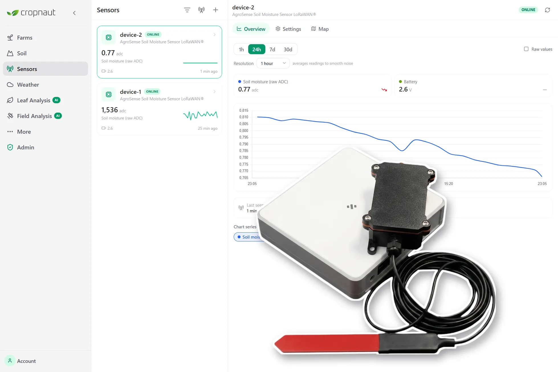
Add LoRaWAN sensors to layer real-time soil and weather data on top of your satellite view.
Cropnaut analyses your satellite data, weather forecast, and sensor readings, then tells you exactly what's happening and what to do about it.
Live on pilot farms in Hungary — built by a team that believes every farmer deserves the same tools as the largest agricultural operations.
Start with software only, or add a hardware kit when you're ready.
Satellite monitoring, AI leaf & field analysis, soil-moisture forecasts, and scouting — the full software platform.
LoRaWAN soil & weather sensors, plus the full platform subscription bundled in. Real-time field data from day one.